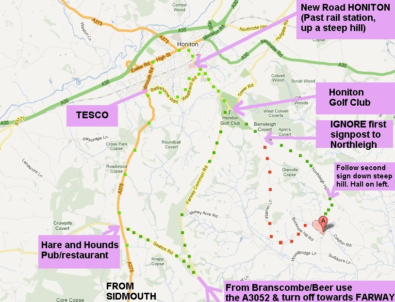
From High Street HONITON, take the road past the rail station (this is called New Road).
Continue passing the Golf Club on your left. IGNORE the first right turning to Northleigh - this would lead you down the red dots. Take the second turning right, down a steep hill, the hall is at the bottom of the hill on your left. The right turning you need is 2.1 miles from the Golf Club entrance.
From Sidmouth choose either the scenic route or the slightly shorter direct route.
Scenic route from Sidmouth: A375 as far as the Hare and Hounds. Turn right there on to Seaton Road. After 1.4 miles take a very sharp left turn onto Farway Common Road. Follow this road for 2.8 miles until you reach the Golf Club T junction, where you turn right.
Then follow the directions as from Honiton (ignore the first right turn to Northleigh, take the second one, which is 2.1 miles from the Golf Club junction).
Total distance from the Hare and Hounds = 6.5 miles.
Direct route from Sidmouth: A375 all the way to TESCO then either go via Honiton High St and New Road or cut across via Battishorne Way.