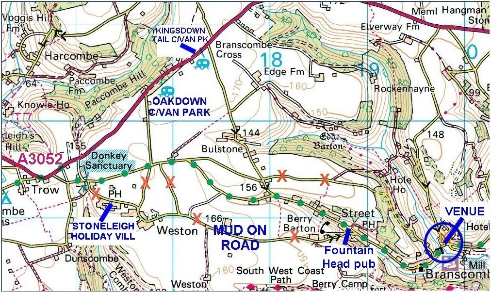
Location map of Branscombe Village Hall Postcode - EX12 3DB
Exact Sat Nav coordinates = N50:41:33 W3:08:15
The main road is the A3052 (Exeter to Sidmouth, Seaton and Lyme Regis)
Branscombe is a very long village - just
because you've arrived doesn't mean you don't have a mile or so still to drive. Keep going
downhill and you should get to the hall.
Travelling from Sidmouth and Sidford along the A3052, turn right at the junction signed
Donkey Sanctuary or further along the A3052 signed Bulstone/Branscombe.
Travelling from Exeter/Sidmouth/Sidford, avoid the roads to Stoneleigh Holiday Village and through Weston in wet weather, it is often deep in mud (pig farming...) and is narrow with few passing places: it is not recommended at night. The best road is probably the one from Branscombe Cross through Bulstone. The road past Oakdown Caravan Park is also OK. The road marked with green dots offers a direct route but avoid the turns that would take you into Weston and to Berry Barton. The village hall is on your left as you reach the river. From the east, there are many possible routes from Seaton and Beer, some include very steep sections of road. The Fountain Head pub is located at the bottom of the steep hill from Berry Barton Farm.